EL BRONX Y LA ESTAZUELA
Clinete: Empresa de renovación urbana
Año: 2017
Estado: Concurso finalista
Diseño: Urbano
Localización: Bogotá
Año: 2017
Estado: Concurso finalista
Diseño: Urbano
Localización: Bogotá
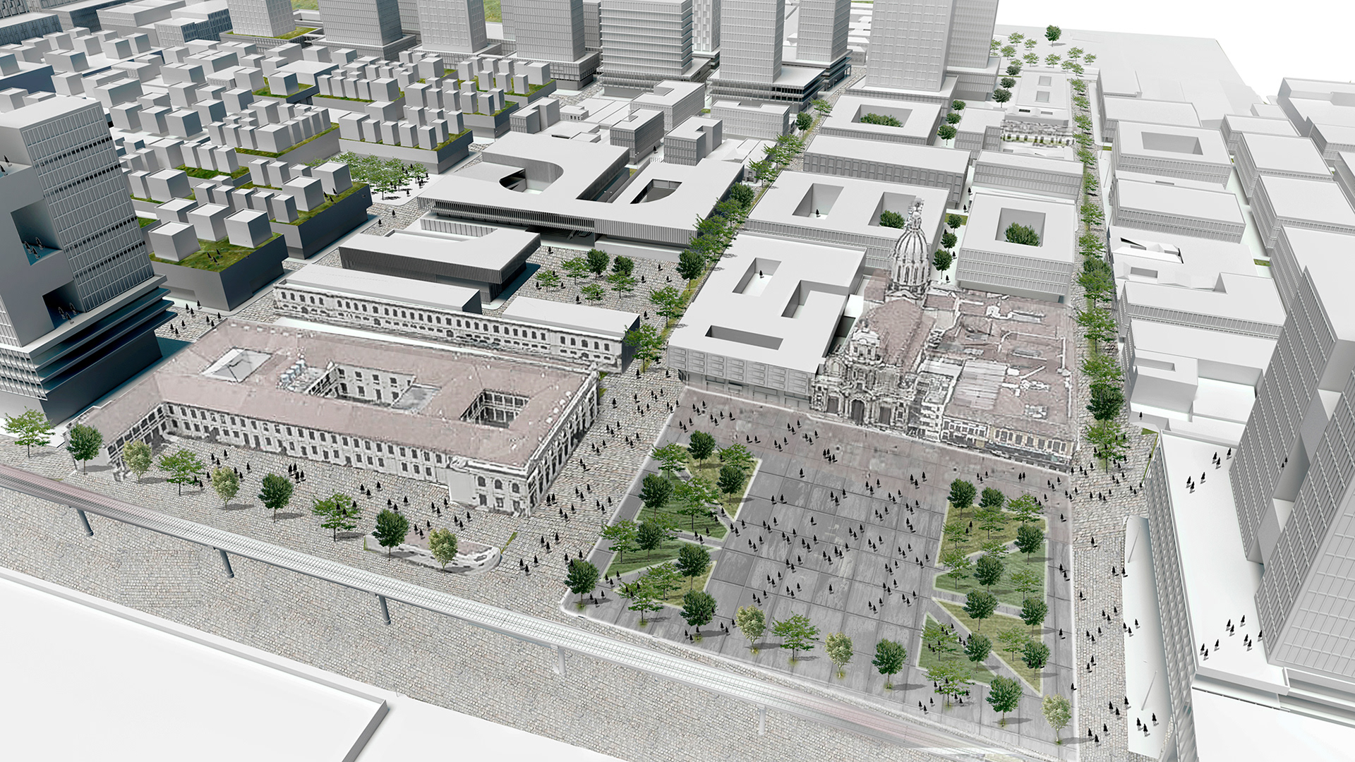
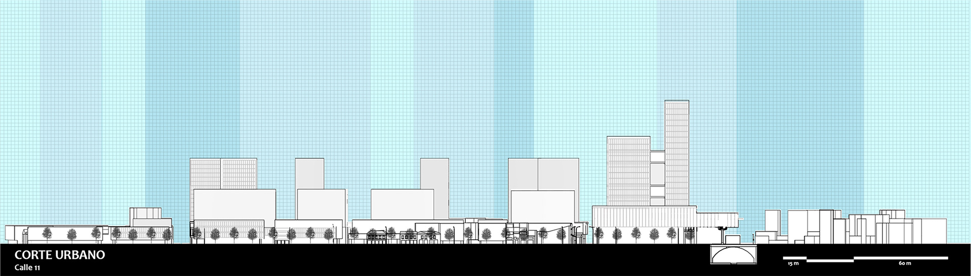
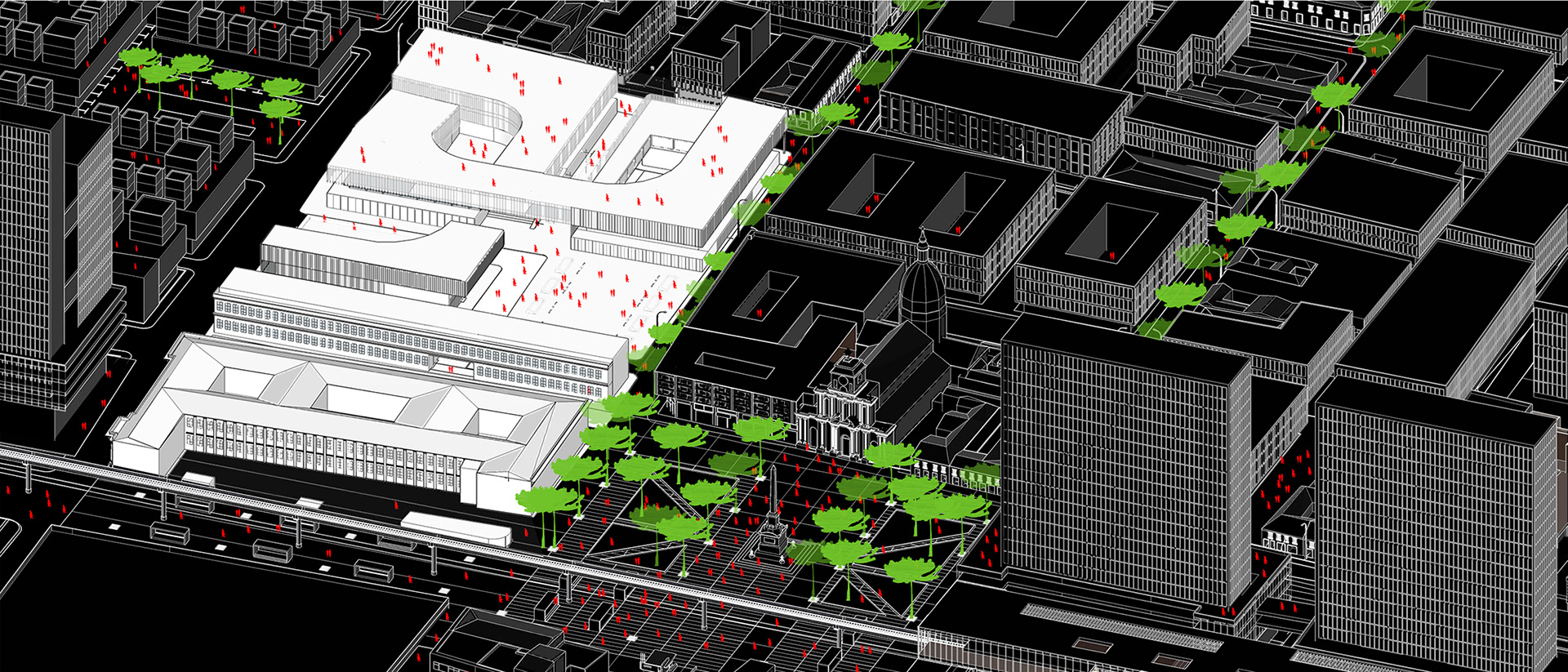
Due to its central condition, the heritage presences and projects that will affect it in the future(Metro, Mariscal Sucre avenue, connection with the Estación de la Sabana and the suburban train), the zone of the“Voto Nacional” and the Estanzuela lends itself to construct an ambitious scenario that reflects the need for modernization of this sector, and the entire metropolitan conglomerate. Based on the pre-existing functional structure, the architectural heritage located in the area, and the future transformations derived from the interventions in the infrastructures located in its perimeter, the area is divided into three stages or zones of intervention organized as follows:
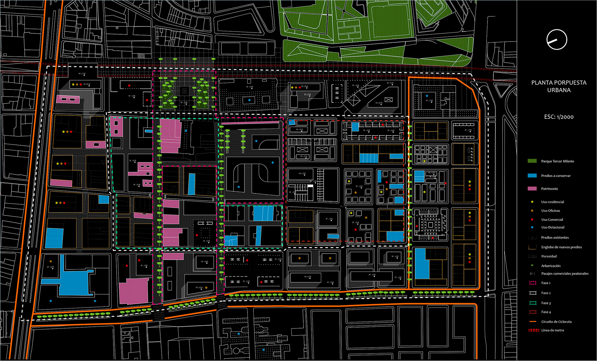
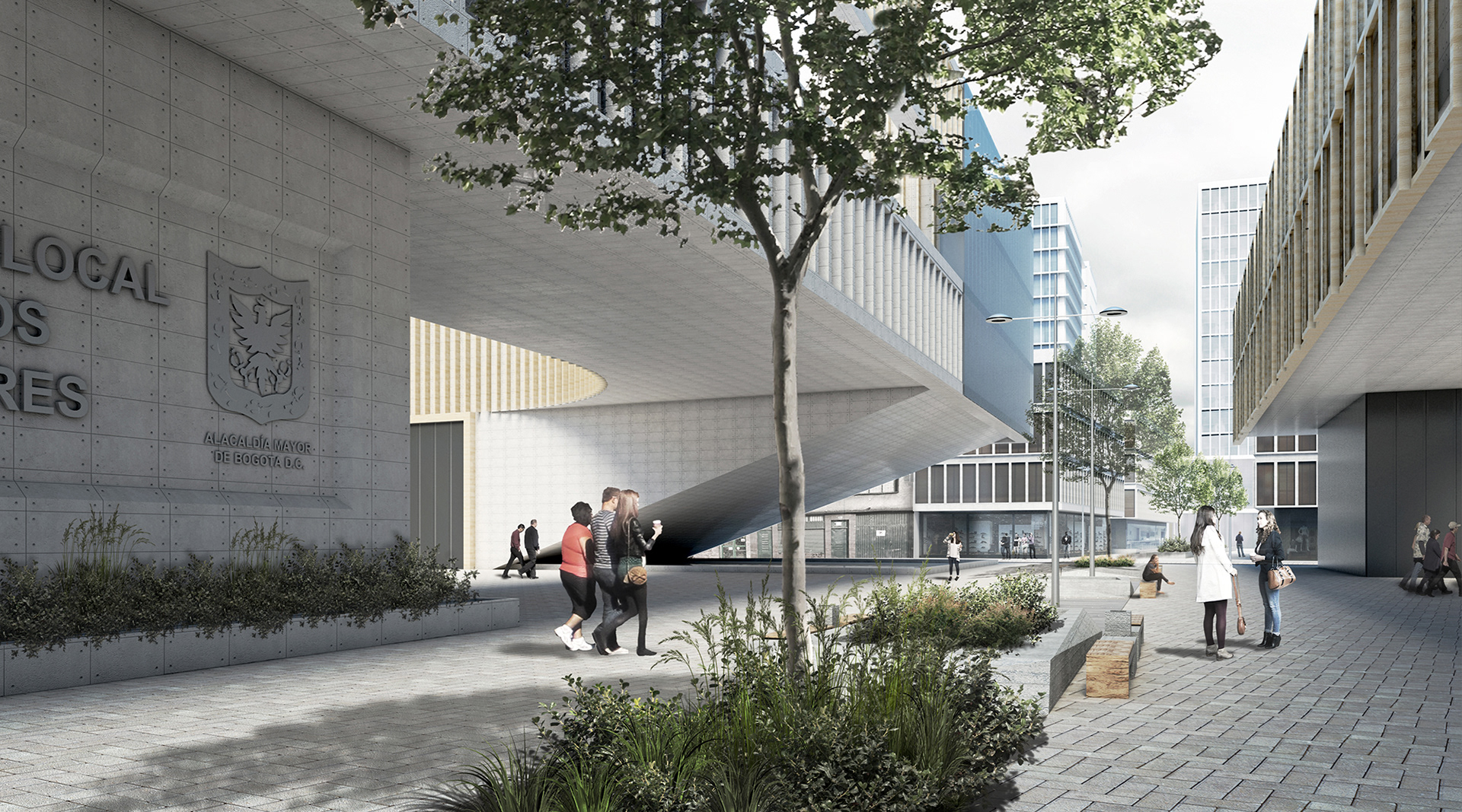
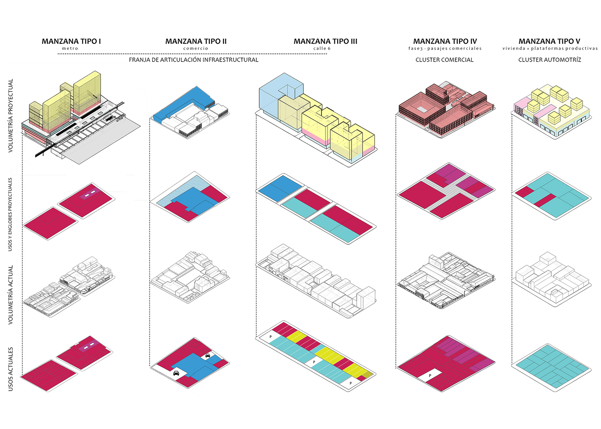
1. Heritage and commercial integration axis: The first area is constituted by the influence zone of the streets 11 and 12, which became pedestrian to connect by a wide scale axis the square ofBolivar, the square of the Voto Nacional, and the PlazaEspaña, integrating the heritage elements located throughout this and the new intervention in the zone of the Bronx. At the same time, this axis connects the commercial areas of San Victorino, the National Vote, and San Andresitoguaranteeing spatial continuity between them.
2. Infrastructural articulation ring: The second area is constituted by a perimetral ring located on the fronts of Caracas avenues, Avenida Mariscal Sucre, Avenida 6, and Calle 13 on which, and take advantage of future projects, It is intended to increase the current buildability To allow the implementation of new activities with the aim of increasing the density of housing in the area, generating a high degree of a mix of uses and capturing the necessary capital gains to guarantee the resources for public interventions.
3. Commercial Cluster: The third area corresponds to the commercial zone of the NationalVote, for which it is foreseen the reorganization of its building structure will more efficient the use of the blocks to avoid the current congestion derived by the interference between pedestrian and vehicular flows.
4.AutomotiveCluster/ Residential: The last area corresponds to the automotive cluster located in the sector of La Estanzuela. Recognizing the simultaneous presence of productive activities linked to the automotive activity and residence, it is envisaged the inclusion of new building typologies that allow the presence of these activities, avoiding the current interference between them.
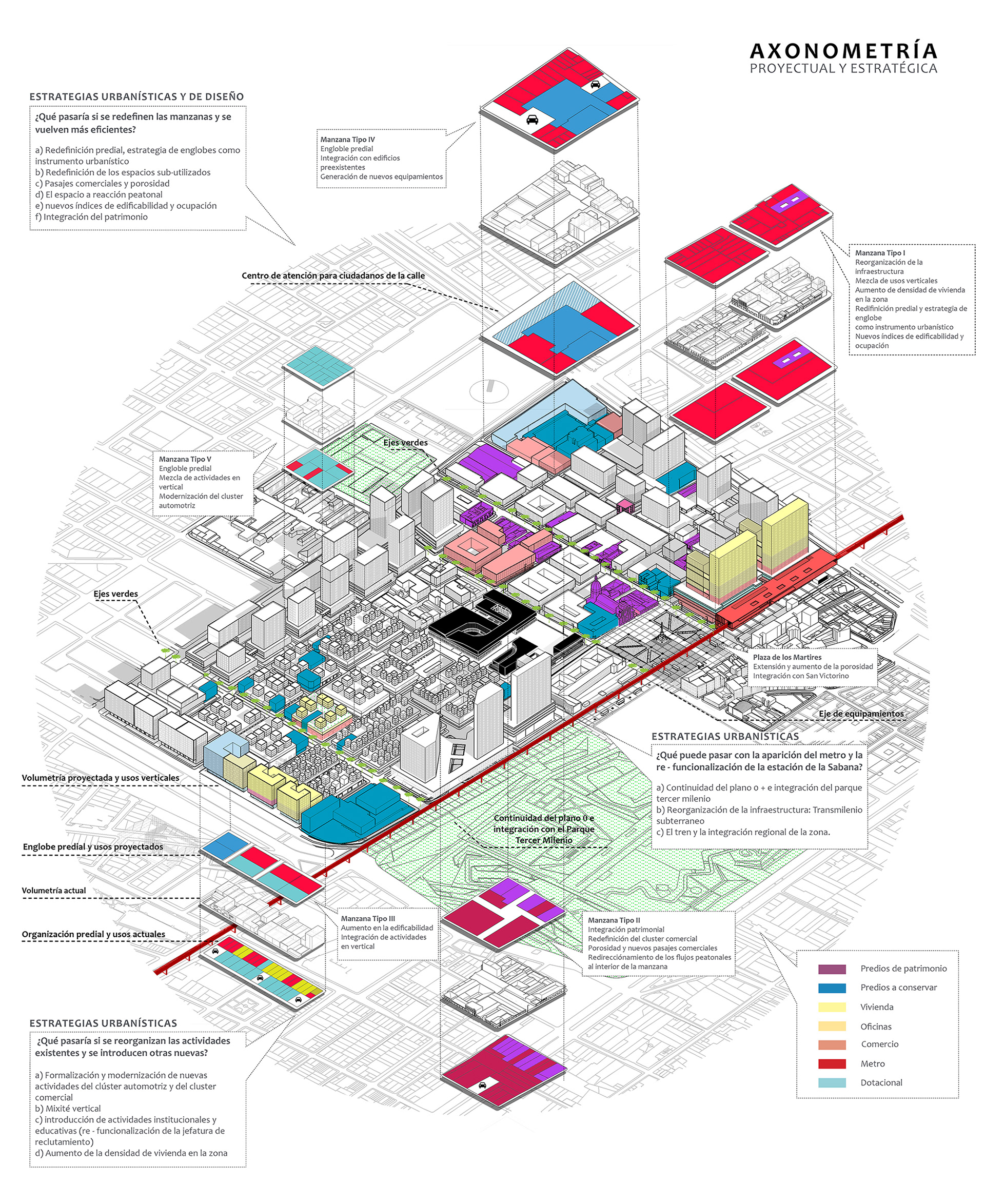
This sector, strategically located and dynamic at the economic level, is characterized by an obsolete and inefficient structure with high levels of deterioration. Therefore, the proposal redefines its condition of centrality through a scenario based on simple questions formulated from the current condition of the territory and the possibilities opened by projects that in the short and medium term will change their appearance. The objective is to open project possibilities and generate urban strategies that are presented through a territorial image that represents the desired landscape for the area.
1. What would happen if the blocks were redefined and became more efficient?
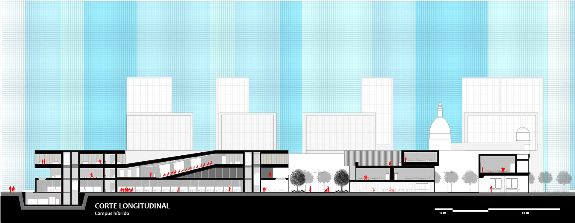
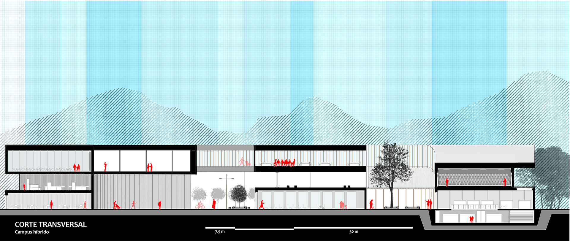
The morphology of the area, especially in the “Voto Nacional” zone, is characterized by large commercial blocks with inefficient occupation werethemainactivities are located on the edges, while the centers are underutilized and occupied by spaces such as warehouses and parking lots. Therefore, the project seeks to make the occupation of these more efficient through the application of plot organization strategies that allow homogenous distribution of uses through the creation of commercial passages that guarantee pedestrian porosity within the block and resolve the interference between pedestrian and vehicular flows.
2. What would happen if existing activities were reorganized and new ones were introduced?
The area is characterized by a monofunctional condition, where commercial and productive activities prevail. Therefore, the project introduces design strategies that seek to modernize the automobile and commercial clusters, increase the density of housing in the area, and introduce new institutional and educational activities. For this reason, new typologies are proposedtoguaranteea24hours’occupationand a high level of vertical "mixité".
3. What can happen with the construction of the new metro line and the re-functionalization of the Sabanatrain station?
The future construction of the elevated subway allows for the reorganization of the existing infrastructure by undergrounding the Transmileniobus linet to allow pedestrian continuity in the zero planes of the project with the Termer Mileniopark and the heritage axis. Finally, the re-functionalization of the station of La Sabana as an arrival point for the commuter train will increase the strategic and central condition of the piece turning it into a regional centrality.