PARQUE TERCER MILENIO
Clinete: Instituto Nacional de Deporte (IDRD)
Colaboración: Estudio Altiplano
Año: 2017
Estado: Concurso entregado
Diseño: Urbano
Localización: Bogotá
Colaboración: Estudio Altiplano
Año: 2017
Estado: Concurso entregado
Diseño: Urbano
Localización: Bogotá
Due to its central location, the patrimonial presence, and the projects that will affect it in the future(Metro, connection with La Sabana station and the suburban train, the zone of the National Voteand the new area of orange economy, Project Ministries, a partial plan of San Bernardo and the commercial center Cielos Abiertos) the Parque Tercer Mileniolends itself to develop an ambitious scenario that reflects the need for modernization of this sector. In this sense, the park is taken as the detonator of the process of renovation of the strip between Streets 1 and 26 between Caracas and Decimaavenues.
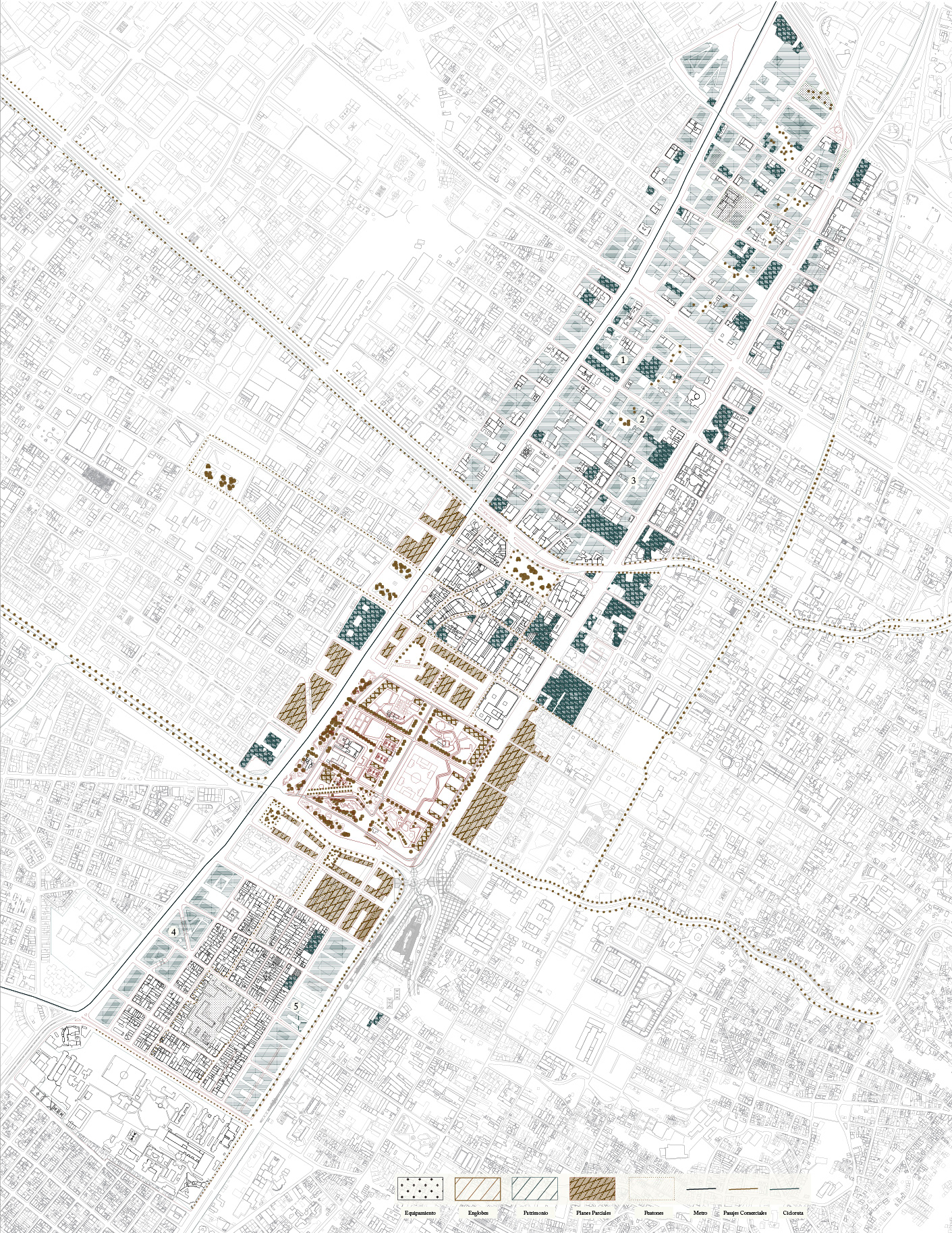
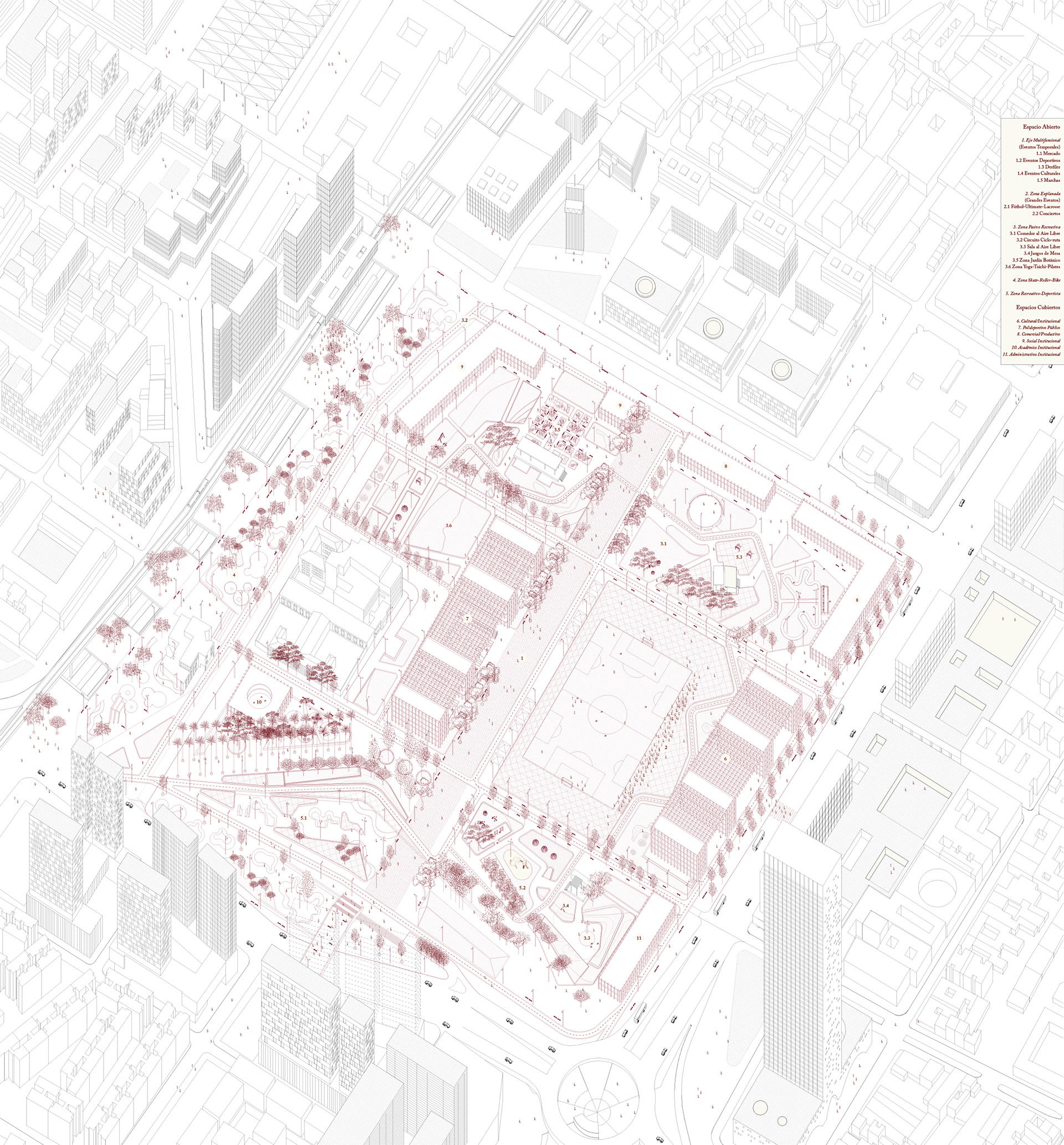
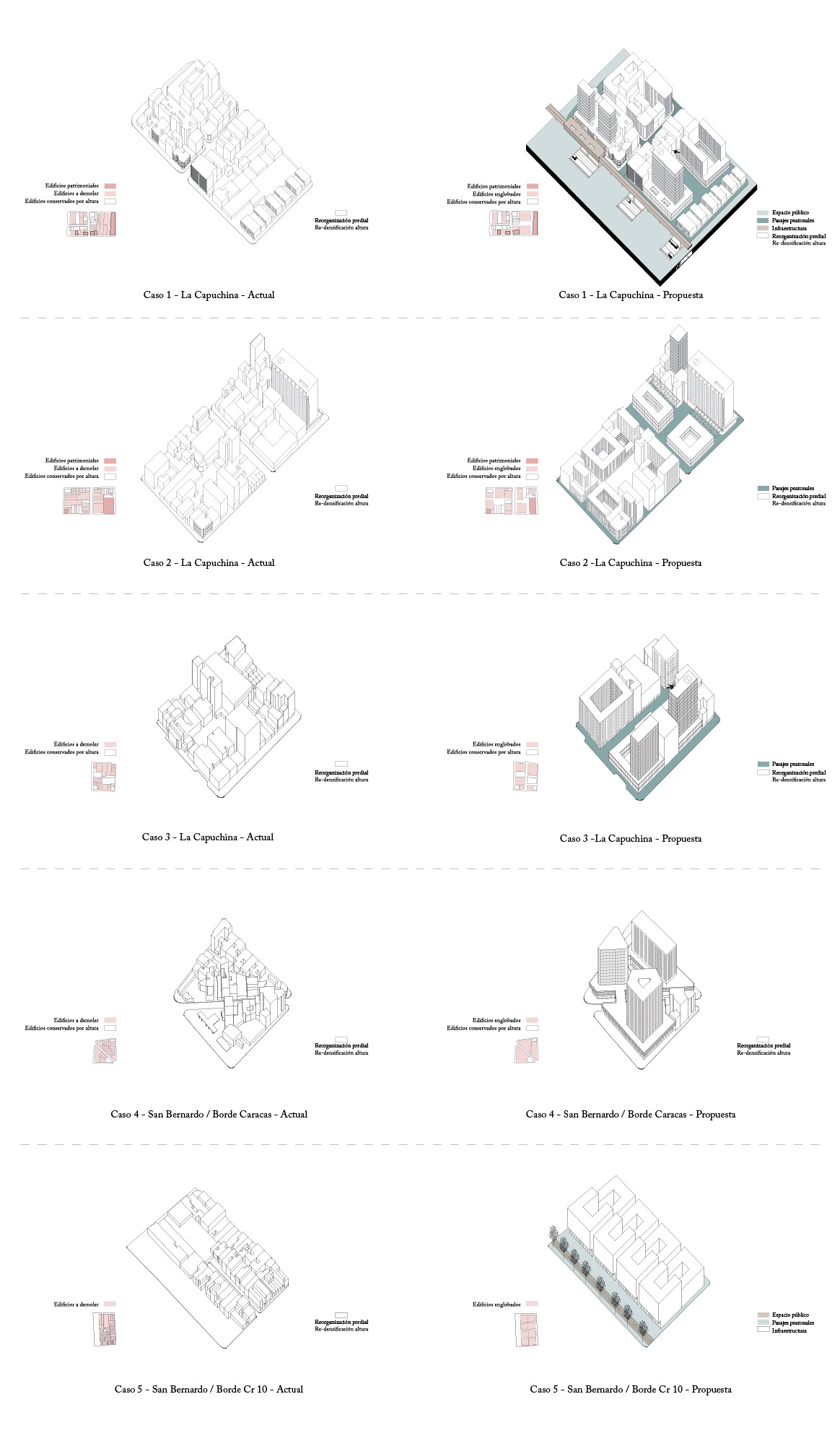
Based on the pre-existing morphological structure, the architectural heritagelocated in the area and the future transformations derived from the interventions in the infrastructures and projects located in its perimeter, the area is divided into four stages of intervention organized in the following way:1. San Bernardo Border Strips: The first area consists of the blocks located on the tenth and Caracasavenuesin the sector of San Bernardo, which are reconfigured by encompassing the lot and increasing itsF.A.R with the objective of constructing an urban profile adapted to the preexisting infrastructure (Transmilenio) and projected (Metro elevated), to generate a mix of uses and more public space. A wide-scale pedestrian axis connects the area from the San Juan de Dios hospital to the Bicentennial Park to ensure pedestrian continuity between all study areas to generate new ways to cross and perceive the city.
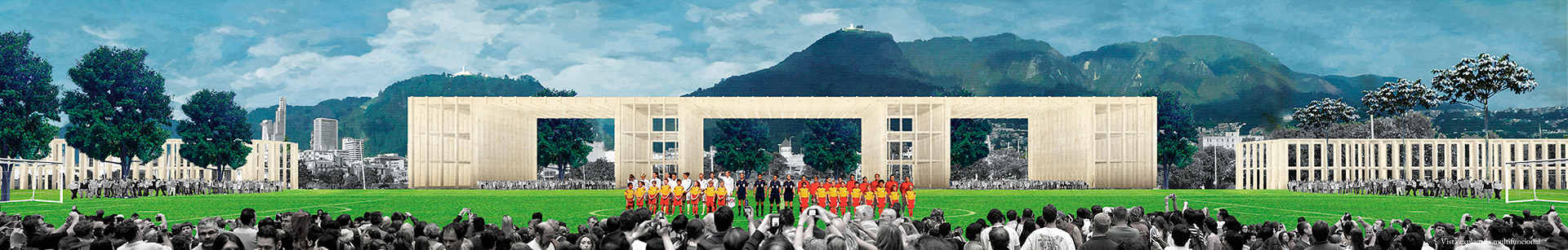
2. Tercer Milenio Park: The second area is constituted by the Park itself. This behaves as a nucleus of activity for the whole sector and connector between the adjacent projects (Project Ministries, PartialPlan San Bernardo, San Victorino, and Orange zone of the National Vote), with which the project seeks to establish a complementary relationship of activities to transform the park into a social exchange machine unique in its kind
3. San Victorino Commercial Cluster: The third area corresponds to the commercial area of SanVictorino, which is for the pedestrianization of its road structure, making the use of the area more efficient to avoid the current congestion caused by the interference between pedestrians and vehicular flows, and thus transform the area into an open skies mall.
4. Alameda and Capuchina Strip: The last area corresponds to the north strip located between streets 19 and 26. Recognizing the preexisting morphology and the presence of modern architectural heritage linked in the construction of 10 Avenue, the densification of the area by encompassing the lots to replace obsolete buildings, generate a system of internal passages, implement new activities with the aim of increasing the density of housing in the area, generate a high degree of mixing of uses densifications and capture the capital gains needed to guarantee resources for public interventions.

Since its construction, The Third Millennium Park has remained a space entity isolated from its context for the following reasons.
1. The presence of the Transmilenio infrastructure on three of its edges does not allow an integration with its surrounding areas.
2. The slowness of the processes of renewal of its borders has not allowed an effective appropriation of this on the part of the inhabitants of this city.
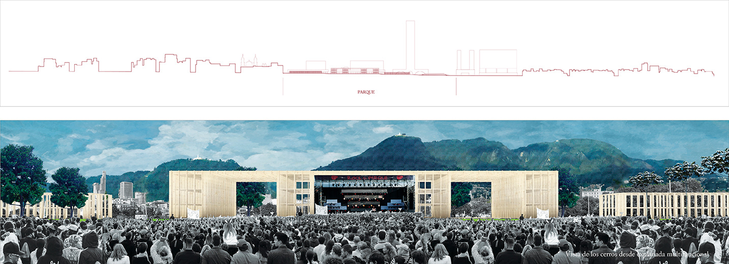
3. The presence of slopes at its edges cuts off the visual relationship and prevents the integration of activities within the park with the context, increasing the sense of insecurity.
4. The low number of programmed areas versus the total size of its surface makes a very low utilization of the park. Due to these conditions, the objective of the project is to transform the Park into a useful space, safe and with an intense social life. To achieve this, it is proposed:
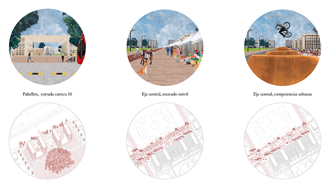
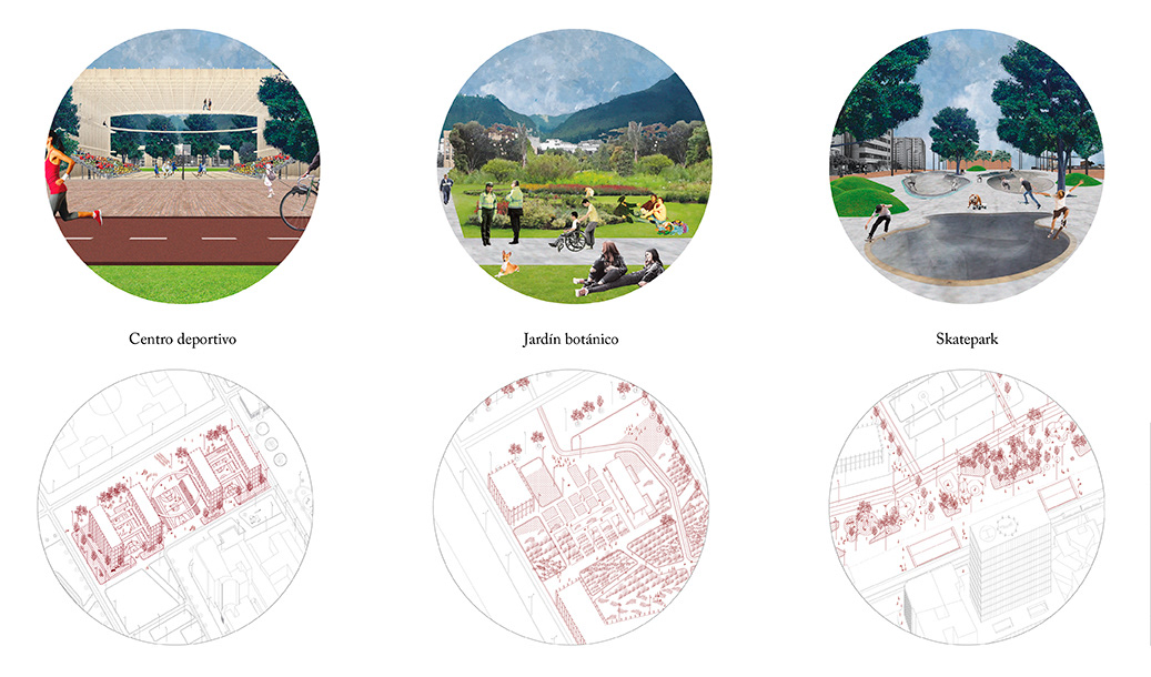
1. The insertion of new activities to transform it into a metropolis an attractor closely related to the activities on its edges. To achieve this, the slopes, elements that created rupture, are transformed into programmed volumes that carry activity and generate security.
2. It is proposed that this programmed border exists in functional connection with the projects and zones located in its surroundings, establishing complementary relations with these.
3. Combine the recreational functions of a traditional park with new programs of a playful, educational, productive, institutional, and cultural nature.
4. The park as a machine of transformation means thinking from the perspective of its capacity to house permanent activities, cyclical and ephemeral, which respond with elements such as the esplanade for events or the central axis as a multifunctional element, giving the park an active, inclusive and safe at different times of the day and night.
5. The new project must conclude the intentions in terms of connectivity of the pre-existences, taking the central axis on the 6th to reach the partial plan, San Bernardo.
6. Through the formulation of the landscape the memory of the buried rivers that converge in the area is recovered, this new landscape structure remembers the history and ties the hills as a focal point of the park
Therefore, it seeks to build a heavily programmed park or park plaza where stable and permanent functions converge with other ephemeral and cyclical typical of a city like Bogota.